
From Fourteenth South to 3500 South to a Highway.........
The Story of 3500 South — From Fourteenth South to a Highway on the Lincoln Route
Long before it was known as 3500 South, one of West Valley City’s busiest thoroughfares was originally called Fourteenth South Street. In the early 20th century, as Salt Lake County grew, the street was an important link for farmers and settlers traveling between Salt Lake City, Granger, Hunter, and Magna.
In 1916, Salt Lake County and Salt Lake City worked to standardize street names to create a logical grid system for the growing region. As part of this renaming, Fourteenth South Street became 33rd South (3300 South) east of Redwood Road. But west of Redwood Road — as the road extended into the rural farmlands of Granger — it was realigned and continued as 3500 South, reflecting its distance from the Salt Lake Temple grid point downtown.
At the same time, other nearby roads were renumbered:
Thirteenth South became Twenty-Seventh South (2700 S)
Fifteenth South became Thirty-Ninth South (3900 S)
Sixteenth South became Forty-Fifth South (4500 S)
Seventeenth South became Fifty-First South (5100 S)
In 1921, Fourteenth South/3500 South was officially designated a state highway, stretching from State Street westward to the Tooele County line — about 16 miles. This upgrade was part of a larger push to build modern, paved roads for the rapidly growing Salt Lake Valley.
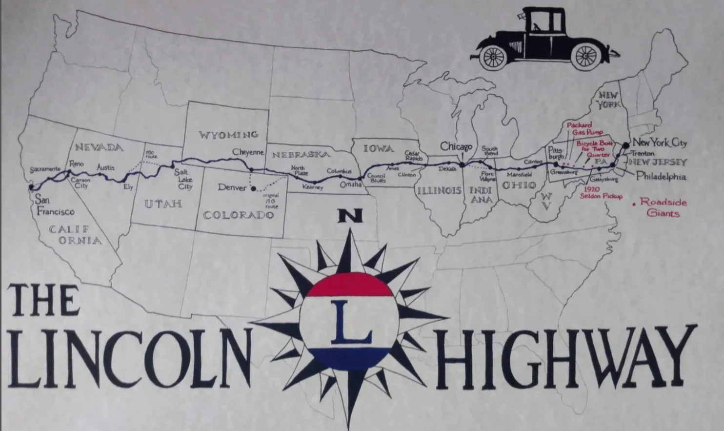
3500 South is also historically significant as part of the Lincoln Highway, America’s first transcontinental highway for automobiles. Established in 1913, the Lincoln Highway passed through Utah along several important east-west routes — including stretches of today’s 3500 South — connecting the region to a national network that linked New York to San Francisco.
Over the decades, 3500 South has carried everything from wagons and streetcars to early cars and modern heavy commuter traffic. Today, it remains a vital state highway and commercial corridor, lined with neighborhoods, schools, businesses, and traces of the farms and open land that once made Granger, Hunter, and Magna some of the valley’s earliest western communities.
Lincoln HIGHWAY
To follow the old route through Salt Lake City:
Exit I-80 at Foothill Blvd (Exit 129/Exit 129B) and immediately take Parleys Way, which becomes 2100 South.
Turn left (south) on State Street.
Turn right (west) on 3300 South, which becomes 3500 South.
The original route enters Kennecott Corp. property at Magna.
From 3500 South, turn right (north) onto 8400 West.
Turn left (west) onto 2700 South.
Turn right (north) onto 9180 West.
Turn left (west) onto UT 201.
Follow UT 201 to I-80 westbound.
3 miles later, take Exit 99-UT 36 and follow UT 36 south to Tooele.
South of Tooele, make a right on UT 199, and go over Johnson’s Pass.
Orr’s Ranch is just southeast of the intersection of UT 199 (Lincoln Highway) and Skull Valley Road.
To return to I-80, take Skull Valley Road north.
All of these roads were once part of the Lincoln Highway