From Homestead to Highway: Jones Farm, 5755 West 3500 South
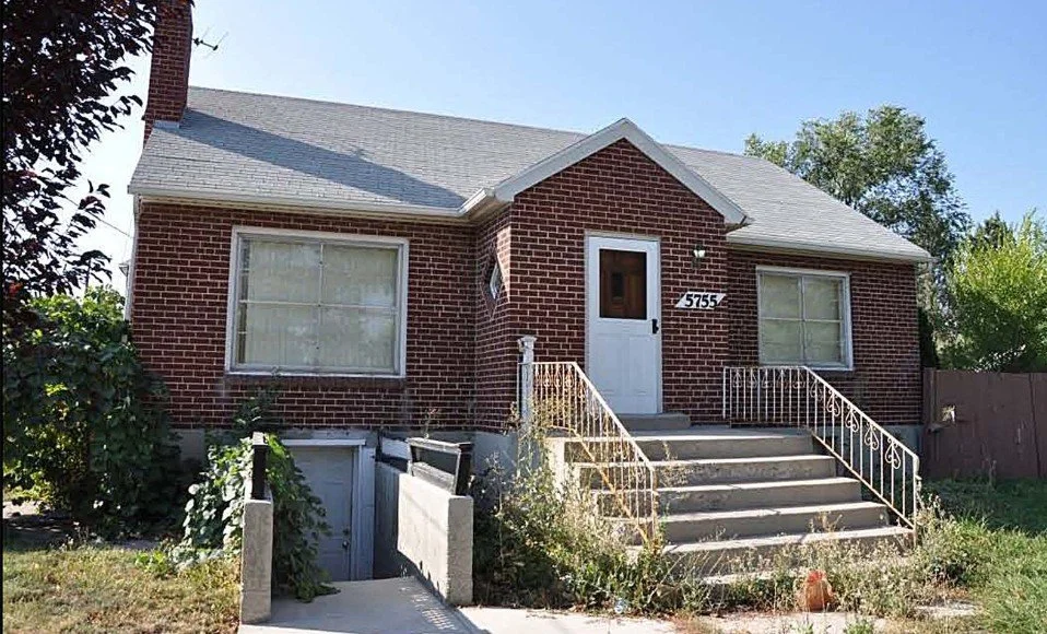
Remembering 5755 West 3500 South
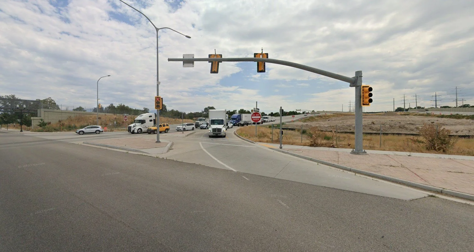
The home once standing at 5755 West 3500 South is gone now—its place taken by the Mountain View Corridor freeway—but its story remains rooted in the history of Granger’s early families.

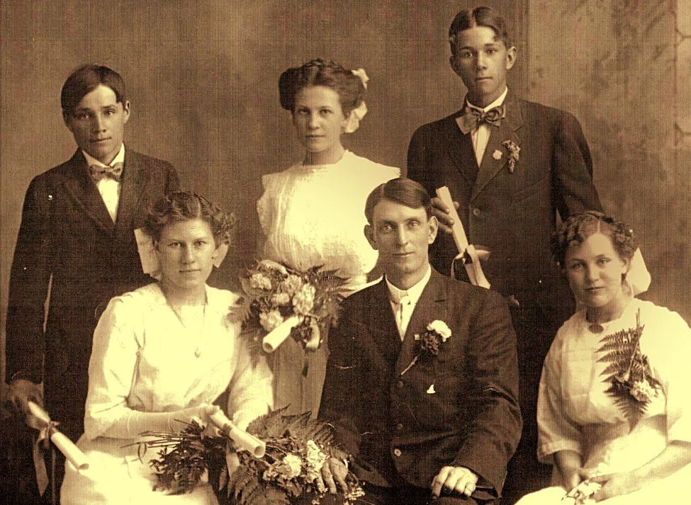
Alfred and Hannah Jones with their children—pioneers of the Granger area and founders of the historic Jones Farm at 5755 West 3500 South
The land was originally part of an expansive farm and ranch owned by Alfred Abraham Jones and his wife Hannah Maria Gibbs Jones. Alfred, born in 1850 in South Wales, immigrated to Utah and married Hannah in 1875. Together they raised five children: Alfred Thomas, Charlotte, Horace, Robert, and Willard.
Property records suggest that Alfred and Hannah deeded a large portion of their land—including the future site of 5755 West 3500 South—to their son Robert Jones and his wife, Elizabeth, sometime before Alfred’s passing in 1927. After Hannah’s death in 1938, Robert deeded the property to his brother and sister-in-law, Willard and Mary Alice (Warr) Jones.
By the late 1940s, ownership shifted to William R. Bailey, who is recorded as the property owner in 1948, the year the residence was reportedly built (though a 1949 tax note suggests construction began in 1947). Interestingly, Willard Jones’s name still appears on a 1949 tax reappraisal card, indicating that he may have retained ties to the land even then.
Willard Jones, a former owner of the property at 5755 West 3500 South, was a beloved school principal whose dedication to students and the community left a lasting impact on generations of Hunter families.
In 1960, Bailey sold the property back to Willard and Mary Alice Jones. Six years later, in 1966, the Joneses sold it to Vao and Florence “Flossie” Bowers, who held it until 1976, when it passed to Lloyd R. Winn. In 1980, it was purchased by John and Lois McNeil, and eventually, in 2011, the property was deeded to the Utah Department of Transportation (UDOT). Soon after, the historic home was demolished to make way for the Mountain View Corridor Project.
The most beloved chapter of this property’s story is tied to Willard and Mary Alice Jones. Willard, born in Hunter, Utah, in 1883 to Alfred and Hannah Jones, became a respected and well-loved school principal. His wife, Mary Alice Warr, born in Granger in 1885 to David and Phyllis Lye Warr, married Willard in February 1911. Together they raised seven children. Willard passed away in 1971, and Mary Alice followed in 1975.
Though the home itself no longer stands, the land holds generations of memories—from the pioneering Jones family, to the hardworking Bailey and Bowers families, to the last residents before its removal. The freeway may have erased the structure, but the history of 5755 West 3500 South remains woven into the story of Granger.
Water and the Shallow Ditches of 5755 West 3500 South
For the early families who lived on the land at 5755 West 3500 South, water meant everything. Farming, gardening, and even everyday living in Granger depended on careful management of ditches and canals. On this property, shallow, concrete-lined ditches carried precious water to the fields, orchards, and home sites.
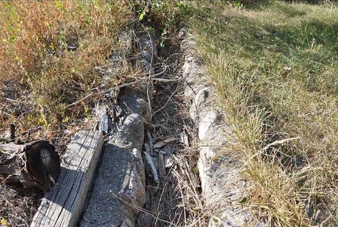
Ditch 1 was the main line of flow. It entered from the west, ran east along the northern end of the yard, then turned south down the west side of the residence. From there it turned east toward the garage, curved between the garage and an outbuilding, then angled southeast before continuing straight south to the far boundary of the property. Much of this ditch was lined with concrete, and its southern stretch was reinforced with both concrete and stone. Just 6 inches deep and 10 inches wide, it was U-shaped with a flat bottom—small in size, yet vital in purpose.
Ditch 2 carried water from east to west along the northern boundary of the property, just south of the sidewalk on 3500 South. Like Ditch 1, it was U-shaped and concrete-lined, about 6 inches deep and 10 inches wide, though with one notable feature: its northern wall was slightly higher than the southern wall, a simple but practical design to help control the flow.

Along the eastern edge of the property, a low concrete wall also marked boundaries and guided water flow. Flush with the ground, about 6 inches wide, it ended in a broken chunk of concrete near the northern edge—evidence of age and long use.
Though narrow and shallow, these ditches played a critical role in the life of the land. They carried irrigation to fields and gardens, sustained animals and crops, and allowed families like the Joneses to make the most of their farm. In a dry valley where every drop mattered, these little watercourses were lifelines, silently supporting the generations who called this place home.
UDOT saw fit to bring major change to our community with the construction of the Mountain View Corridor. What was once farmland, quiet neighborhoods, and open space has now become a busy transportation route—shaping growth, accessibility, and the very landscape of West Valley City